Welcome!

Running routes are organized by region.

Route descriptions include information about the course including distance, difficulty, condition of path, etc. along with parking, water/restroom locations, and more. For each entry there is a Google Map marking the route, links to maps or trail information, and photos of the course.

After training for several marathons, I've spent a lot of time seeking out, researching, and exploring appropriate places for long training runs. Here I have compiled the details on the most scenic and interesting routes to share with my fellow runners. Enjoy!

Running Places By Region

Showing posts with label South Bay. Show all posts

Stevens Creek Trail

Stevens Creek Trail

Location: South Bay


Summary: This is a paved bike path that extends about 4 miles from Mountain View to the bay. You can run along the levees and the Bay Trail to add distance to the run. There are some neat pedestrian bridges and you go under a few freeways. It's somewhat shaded for the first couple of miles but exposed as you get toward the bay, so wear sunscreen!


Distance: 8 miles (add distance by running north along the bay)


Conditions: Paved path, some dirt shoulder sections.

Profile: Flat. Actually, you start about 100 feet above sea level and turnaround at sea level, so you may notice the slight grade. There's the couple of bridges/overpasses.


Start/Park: Yuba Drive Trailhead just north of El Camino Real in Mountain View (no fee)


Water: There is a water fountain at the trailhead, one at about 2.3 miles, and one at about 3.1 miles. There are also several parks just off the main path that have water and restrooms. Look for the signs.


Breakfast: Hobee's (2312 Central Expressway)


Los Gatos Creek Trail

Los Gatos Creek Trail
-
Location: South Bay
-

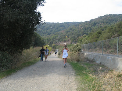
Summary: This is my standard 20 miler. It's got a nice variety of scenery, plenty of water stops, and it's flat. Plus, easily the best breakfast place in the bay area. The trail is easy to follow. There are a few bridges but it's clear that you need to take them, because not taking them will take you to a street with no sign of the trail. I always start this run with a simple loop through the neighborhood: run down Willow St. the way you drove in, then turn left at the Starbucks on Meridian, then go about a quarter mile till you see the trail entrance. From there, just stay on the trail. It's a little painful passing your car at mile 18.7 or whatever, but know that you are almost there and push it to the end. Focus on the cinnamon roll waiting for you at the Los Gatos Cafe.


Distance: 20 miles


Conditions: Paved path with dirt shoulder, then dirt road for about the last 1 1/2 miles.


Profile: flat


Start/Park: Blackford School: 1970 Willow St., San Jose (no fee)

Water: Los Gatos Creek Park at mile 4.2, Several water fountains and restrooms at Vasona County Park which you hit at about mile 6.5 and run through for nearly a mile.


Breakfast: Los Gatos Cafe (15662 Los Gatos Blvd) Home of the 1/2 pound cinnamon roll!!