Location: East Bay
Info Link: http://www.ebparks.org/parks/trails/iron_horse

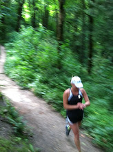
Summary: The Iron Horse Trail is a rails-to-trails project that partially follows a canal. It is super long and you can do a long run at any number of points along the trail. It is generally easy to follow, just look for the signs. This specific version starts near my home in Dublin and runs one-way up to Walnut Creek.
Gmap: Iron Horse Trail
Related blog run report: November 2007 (not this exact run, but similar territory)
Distance: 15.5 miles One-Way (many alternatives available)
Conditions: paved bike path with dirt shoulder at some points
Profile: flat
Start: Trail Crossing at Amador Valley Boulevard in Dublin
Park: on street, walk to trail crossing
Water: Walt Disney School Park at Pine Valley Rd (2.0 miles). *bathroom here! Portopotty*
Central Park at Bollinger Canyon Rd (3.9 miles).
Danville Rd. crossing (8.3 miles)
Just pass old Railroad station at Prospect Ave (8.6 miles) *bathroom here! In old railroad car*
Stone Valley Road (11.4 miles)
Several more fountains at various points along trail over next couple miles
Rudgear Road (13.7 miles)
End: Civic Park, Walnut Creek (at Civic Drive)
Breakfast: Crepes A Go-Go
1432 N. Main St.