Location: South Bay
Info Link: http://www.stevenscreektrail.org/

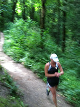
Summary: This is a paved bike path that extends about 4 miles from Mountain View to the bay. You can run along the levees and the Bay Trail to add distance to the run. There are some neat pedestrian bridges and you go under a few freeways. It's somewhat shaded for the first couple of miles but exposed as you get toward the bay, so wear sunscreen!
Gmap: Stevens Creek Trail
Related Blog Post: http://runningstories.blogspot.com/2008/06/brutal-in-good-way.html
Distance: 8 miles (add distance by running north along the bay)
Conditions: Paved path, some dirt shoulder sections.
Profile: Flat. Actually, you start about 100 feet above sea level and turnaround at sea level, so you may notice the slight grade. There's the couple of bridges/overpasses.
Start/Park: Yuba Drive Trailhead just north of El Camino Real in Mountain View (no fee)
Water: There is a water fountain at the trailhead, one at about 2.3 miles, and one at about 3.1 miles. There are also several parks just off the main path that have water and restrooms. Look for the signs.
Breakfast: Hobee's (2312 Central Expressway)