Location: East Bay

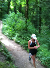
Summary: The Alameda Creek Trail is a regional trail that follows Alameda Creek from the Niles area of Fremont to the bay. It is 12 miles in length so you can do a very long run here. In fact, it connects up with Coyote Hills Regional Park (see index) so you really could run forever. The trail is completely straightforward and easy to follow. If you look at the East Bay Parks map you can find several adjacent parks and alternate starting points on the trail. It's generally not to hot due to the proximity to the bay and there is a bit of shade if you come early. The best part of the run is looking for all the different birds- several kinds of cranes and egrets hang out here.
Gmap: Alameda Creek Trail
Related blog post: http://runningstories.blogspot.com/2008/02/rained-out.html
Distance: 17.0 miles (or any distance you want)
Conditions: One side of the creek has a dirt trail and the other side has a paved trail. If you stay on the side you parked on (see below) you'll be on the paved side. There's a dirt shoulder for the most part.
Profile: Flat, with a few dips below overpasses.
Start/Park: Niles Canyon Staging Area (no fee) Just north/east of Niles Canyon Road on Old Canyon Road (see East Bay Parks map)
Water: The only one I can think of is about 1 1/2 to 2 miles from the start (on the paved side). Carry plenty of your own water!